NOAA Forecasting A Busy 2025 Hurricane Season: Storm Expert Explains Why — And What Meteorologists Are Watching

Satellite data shows Hurricane Milton on Oct. 7, 2024, as it gained strength quickly over the Gulf of Mexico. NOAA GOES
U.S. forecasters are expecting an above-normal 2025 Atlantic hurricane season, with 13 to 19 named storms, and 6 to 10 of those becoming hurricanes.
Every year, the National Oceanic and Atmospheric Administration and other forecasters release preseason outlooks for the Atlantic’s hurricane season, which runs June 1 through Nov. 30.
So, how do they know what’s likely to happen months in the future?
I’m an atmospheric scientist who studies extreme weather. Let’s take a look at what Atlantic hurricane forecasts are based on and why those forecasts can shift during the season.
What Goes Into A Seasonal Forecast
Think of the preseason hurricane forecast as the 30,000-foot view: It can’t predict if or when a storm will hit a particular location, but it can offer insight into how many storms are likely to form throughout the entire Atlantic, and how active the season overall might be.
These outlooks rely heavily on two large-scale climate factors.
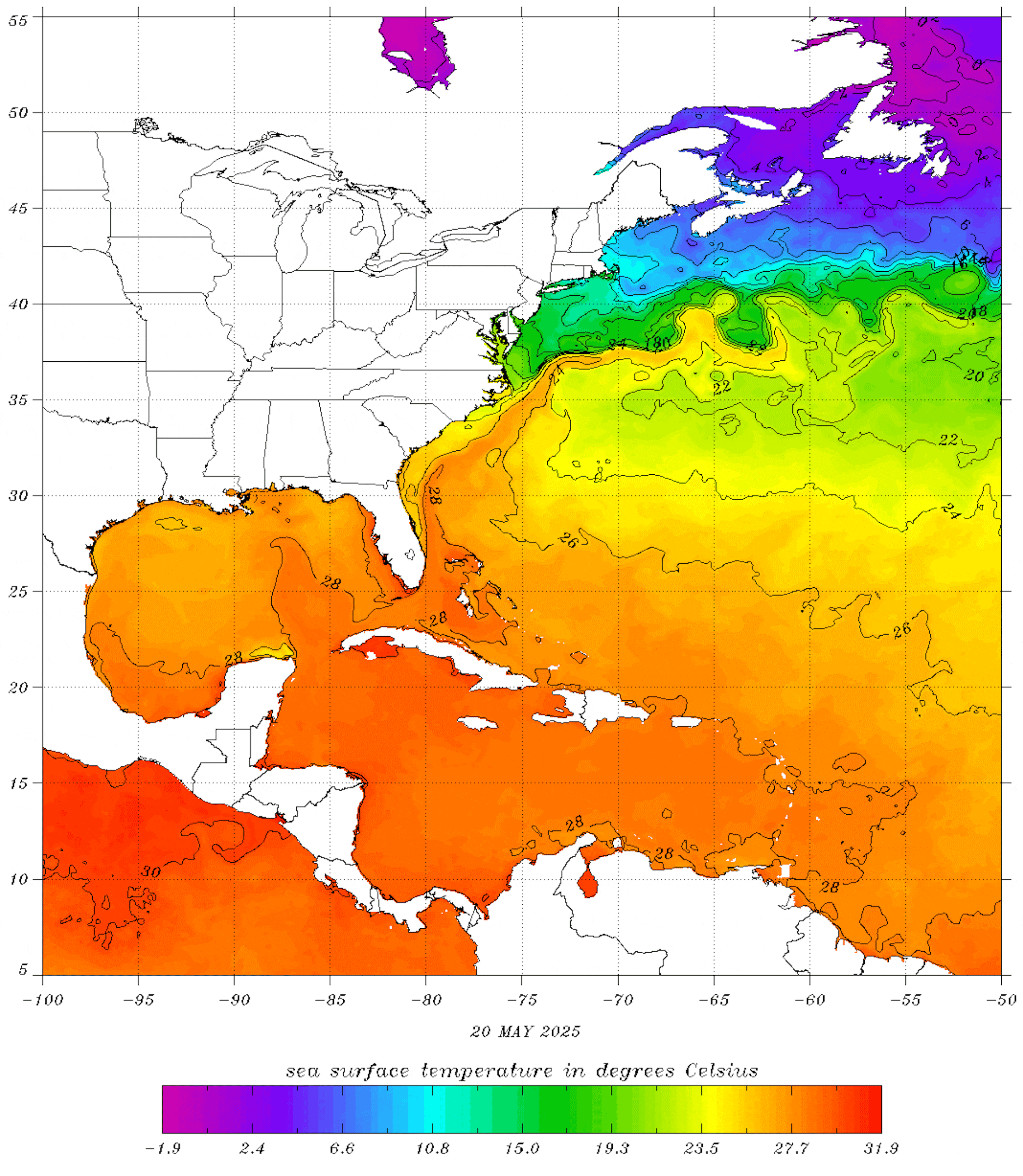
The first is the sea surface temperature in areas where tropical cyclones tend to form and grow. Hurricanes draw their energy from warm ocean water. So when the Atlantic is unusually warm, as it has been in recent years, it provides more fuel for storms to form and intensify.

The second key ingredient that meteorologists have their eye on is the El Niño–Southern Oscillation, which forecasters refer to as ENSO. ENSO is a climate cycle that shifts every few years between three main phases: El Niño, La Niña, and a neutral space that lives somewhere in between.
During El Niño, winds over the Atlantic high up in the troposphere – roughly 25,000 to 40,000 feet – strengthen and can disrupt storms and hurricanes. La Niña, on the other hand, tends to reduce these winds, making it easier for storms to form and grow. When you look over the historical hurricane record, La Niña years have tended to be busier than their El Niño counterparts, as we saw from 2020 through 2023.
We’re in the neutral phase as the 2025 hurricane season begins, and probably will be for at least a few more months. That means upper-level winds aren’t particularly hostile to hurricanes, but they’re not exactly rolling out the red carpet either.
At the same time, sea surface temperatures are running warmer than the 30-year average, but not quite at the record-breaking levels seen in some recent seasons.
Taken together, these conditions point to a moderately above-average hurricane season.
It’s important to emphasize that these factors merely load the dice, tilting the odds toward more or fewer storms, but not guaranteeing an outcome. A host of other variables influence whether a storm actually forms, how strong it becomes, and whether it ever threatens land.
